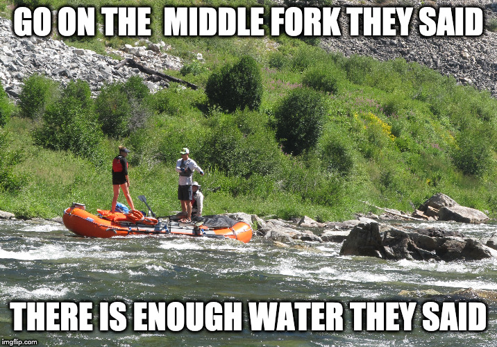
Middle Fork of the Salmon River Flows
Discharge, cubic feet per second
Gage height, feet
(Graphs/data courtesy of USGS)
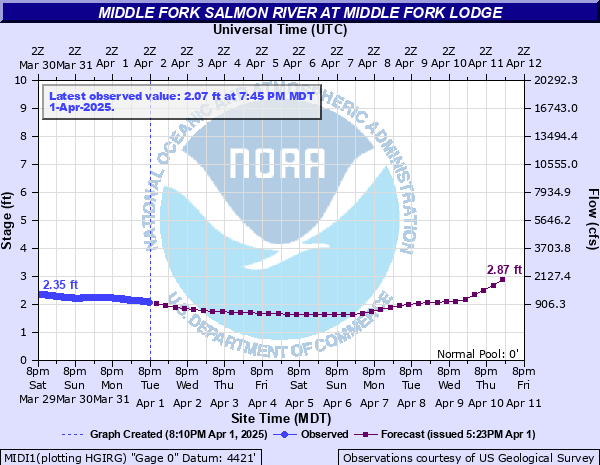
(Graphs/data courtesy of NOAA)
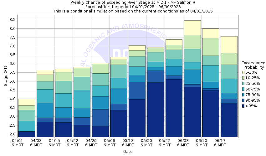
Snow to Flow Relationship for the Middle Fork
Low water: <3′ gage height (low water considerations)
Sweet Spot: 3′-5′ gage height
High water: >5′ gage height (high water considerations)